

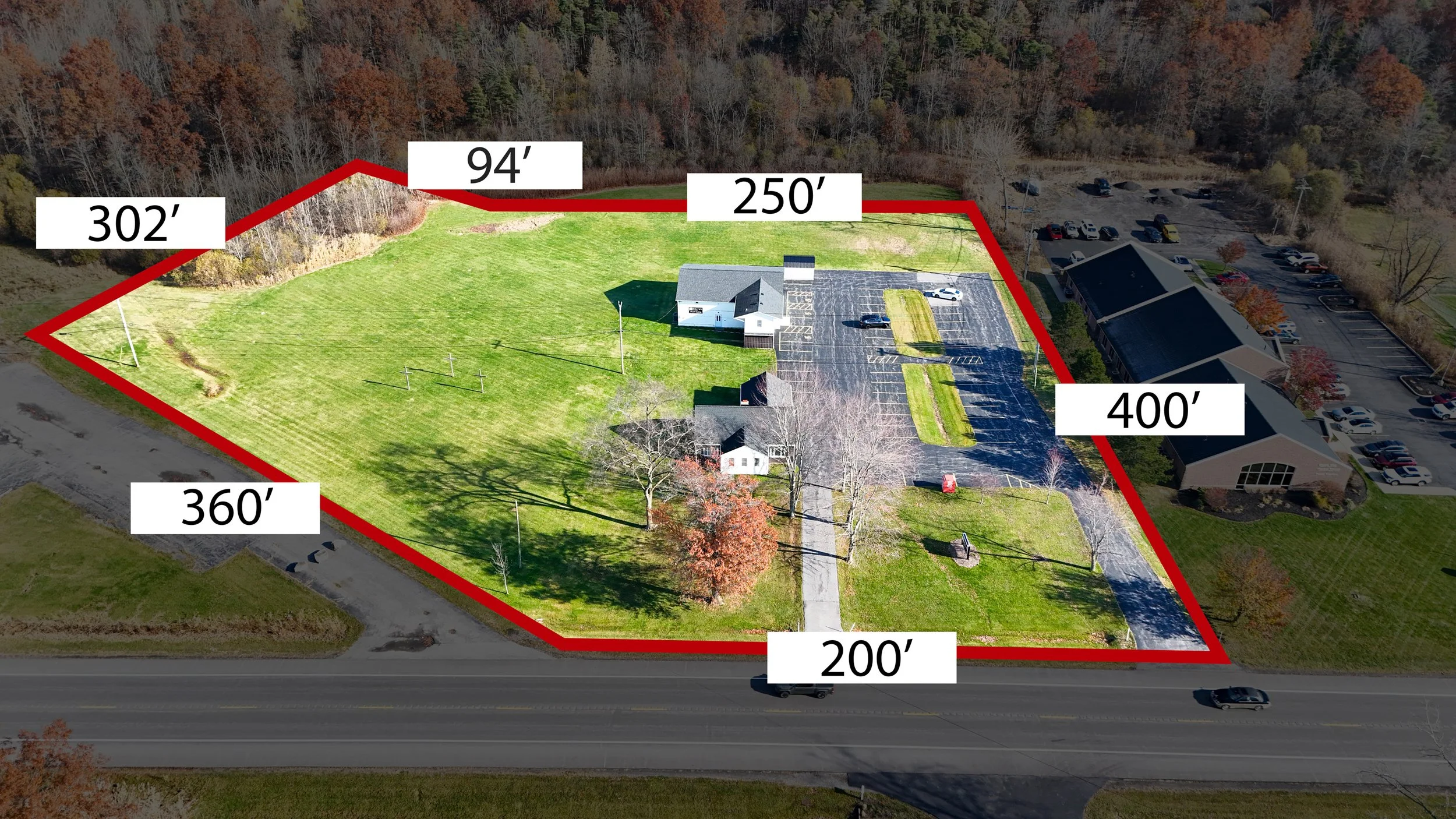
Drone Photos/ Property Lines
Large properties deserve more than standard photos. Our drone imagery captures the full landscape, and our access to parcel data allows us to overlay accurate property lines so buyers can understand the true layout.
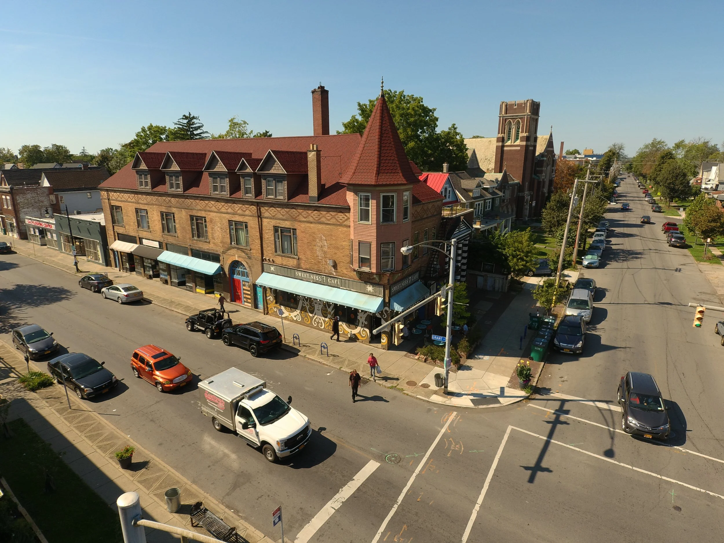
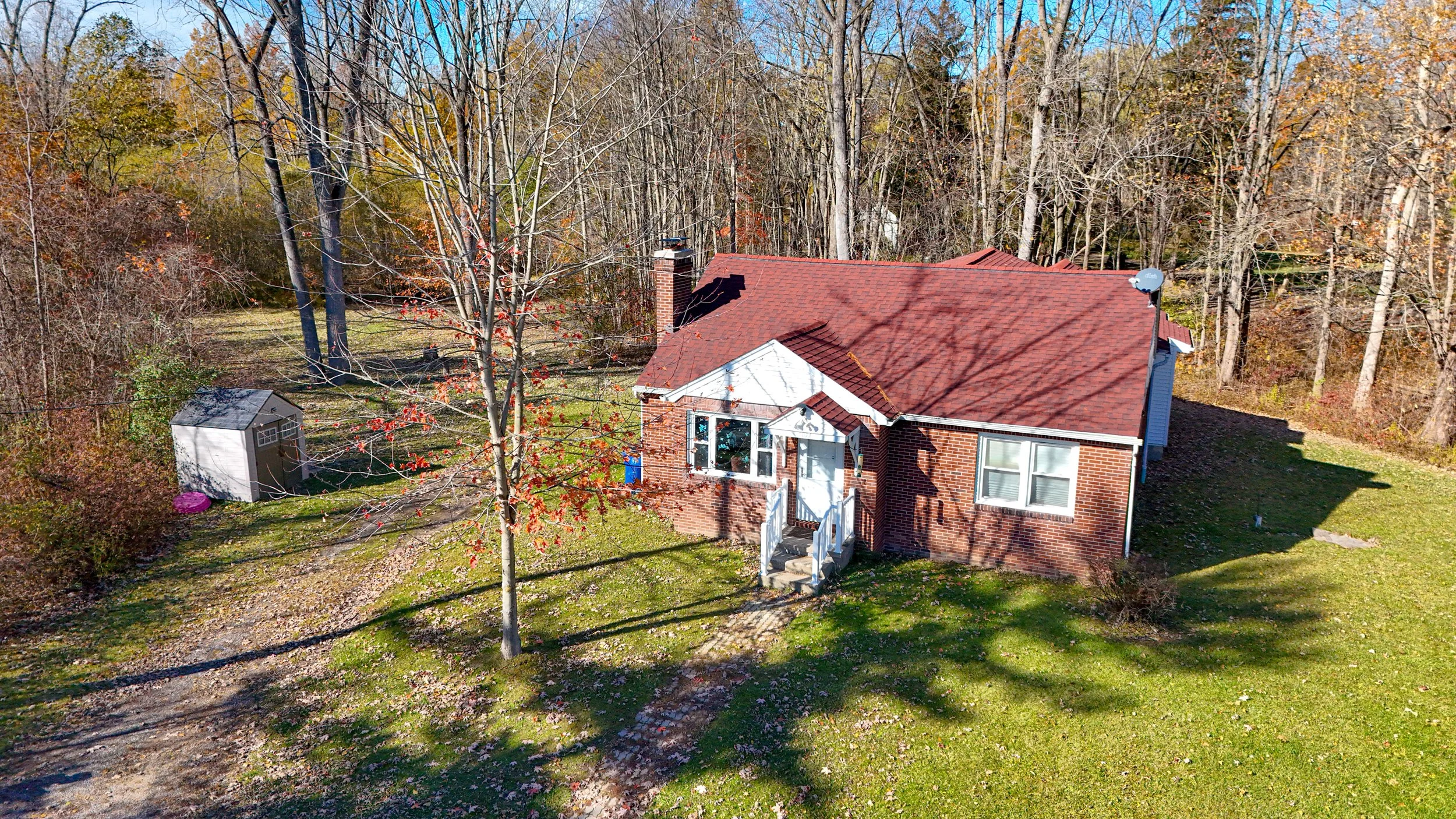
Drone Photography
Drone photography provides a clear, high-angle view of a property that helps buyers understand the full layout, land size, and surroundings. Aerial images highlight features that standard photos miss, making real estate listings more accurate, engaging, and easier for clients to evaluate.

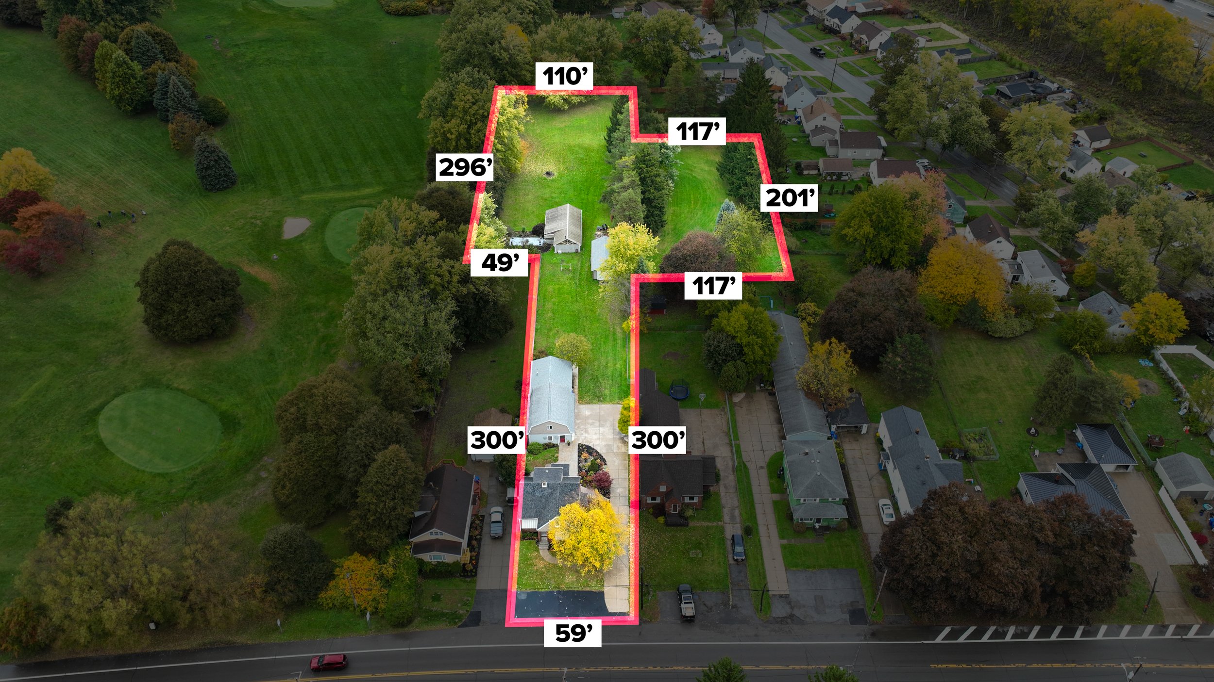
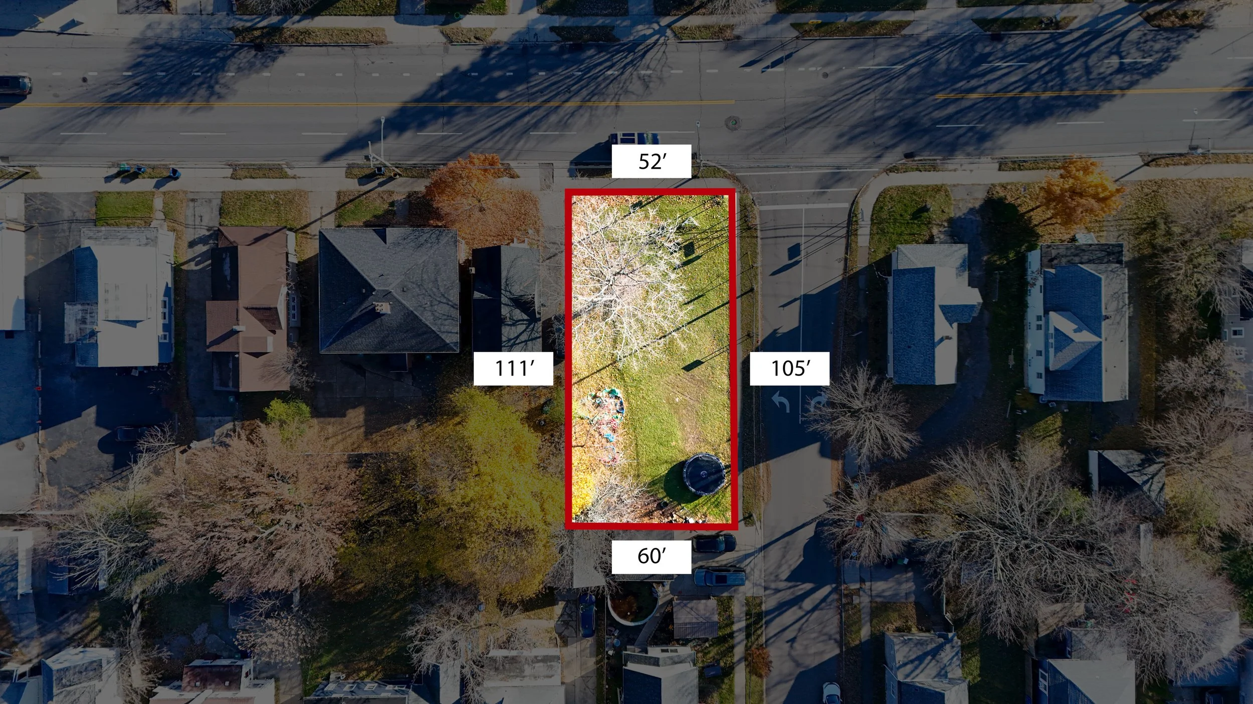
Property Lines
Property line overlays give buyers a clear understanding of a lot’s true boundaries, layout, and size. By using precise parcel data, these visuals show where the property begins and ends, making real estate listings more accurate and easier for clients to evaluate.


We’ve provided this service for over 1,000 properties and we continue to refine it with every project.
FAQs
-
Aerial images help buyers instantly understand the size, shape, and setting of a property. This can increase interest, improve engagement, and make your listing stand out online.
-
Drones require safe flight conditions—clear visibility and low wind. If the weather isn’t safe, we reschedule quickly.
-
Property lines are based on publicly available parcel data. They are a close visual representation but should not be used as a legal survey.
-
Yes. All flights follow FAA regulations, and we ensure we have the proper permissions and safe conditions before capturing photos.
-
They often do. Aerial images give buyers instant clarity, which increases engagement and reduces uncertainty about land size and layout.
-
![Empty photography studio with professional lighting equipment, white backdrop, and black curtains, ready for filming or photoshoot.]()
Professional Headshots
-
![Empty modern apartment with large windows showing a city skyline, overlaid with the text 'Virtual Staging'.]()
Virtual Staging
-
![Bright living room with large windows overlooking a garden, featuring a sofa, armchair, wooden coffee table, lamps, potted plants, and a dining area with a wooden table and chairs.]()
Virtual Tours
-
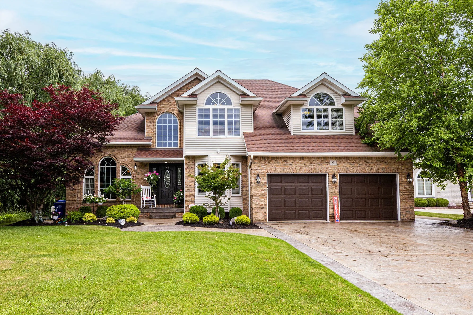
![Front view of a two-story house with brick and siding exterior, large arched windows, a double garage, and a well-maintained lawn with trees and shrubs.]()
Photography